Highway 93 Through Golden: Beautiful, Deadly, and Legally Complex
The drive is stunning. Rocky Mountain foothills rising on your left, the plains stretching east to the horizon on your right, Table Mountain and North Table Mountain framing the town of Golden below. Visitors pull over to take photographs. Real estate agents use the views to sell homes in the communities along the corridor. It is one of the most beautiful drives on the Front Range.
It is also one of the most dangerous roads in Colorado.
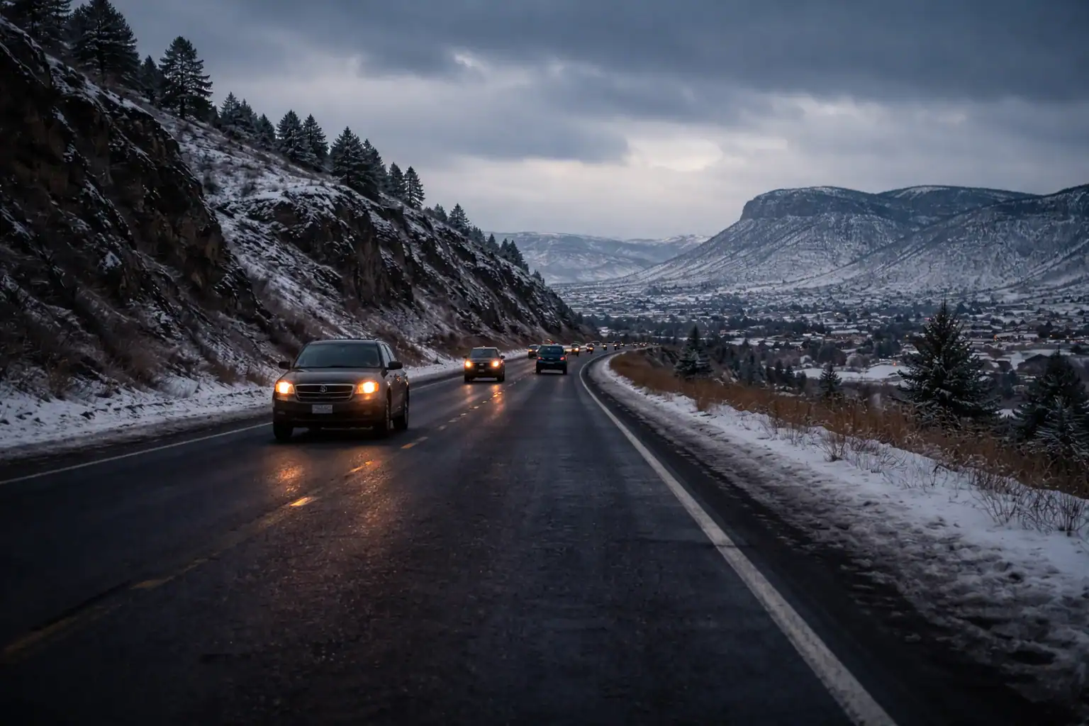
Highway 93 between Golden and Boulder carries roughly 30,000 vehicles per day on a road that is, for most of its length, a two-lane highway with nothing separating northbound and southbound traffic except a double yellow line. Vehicles traveling 55 to 65 miles per hour pass within feet of oncoming traffic moving at the same speed. The closing speed between two approaching vehicles is over 100 miles per hour. The margin for error is measured in inches, and the consequences of crossing that center line are catastrophic.
The Geography That Creates the Danger
Highway 93 follows a north-south route along the base of the foothills, connecting Golden to Boulder through unincorporated Jefferson County and the city of Superior. The terrain is not flat. The road climbs and descends through rolling hills, curves around rock outcroppings, and passes through cuts in the landscape that obstruct sight lines.
These elevation changes create blind spots where a driver cannot see oncoming traffic until it is close. A vehicle attempting to pass a slower car on an uphill grade may crest the hill and discover an oncoming vehicle with less than two seconds of reaction time. At combined speeds exceeding 100 miles per hour, two seconds translates to roughly 300 feet, barely enough distance to recognize the danger, let alone avoid it.
The curves along Highway 93, while gentle by mountain highway standards, are sharp enough to require reduced speed. Drivers who maintain highway speed through these curves push their vehicles toward the limits of tire adhesion, particularly in wet or icy conditions. A vehicle that loses traction on a curve does not slide off the road into an empty ditch. It slides across the center line into oncoming traffic.
Wind is a persistent factor. The corridor between the foothills and the plains creates a natural wind channel. Crosswinds along Highway 93 can be sudden and severe, strong enough to push a passenger vehicle laterally across the lane and powerful enough to destabilize high-profile vehicles including delivery trucks, RVs, and empty commercial trailers. Wind gusts are unpredictable and can occur on otherwise clear and calm-looking days.
The Volume Problem
Thirty thousand vehicles per day is an extraordinary volume for a two-lane highway. For context, many four-lane divided highways in Colorado carry similar or lower volumes. Highway 93 handles this traffic on a road originally designed for a fraction of the current demand.
The growth of communities along the corridor has driven the volume increase. Superior, Louisville, and the unincorporated areas west of Broomfield have added thousands of homes over the past two decades. Many of those residents commute south to Golden, Lakewood, and Denver, or north to Boulder. Highway 93 is their most direct route.
Commercial traffic adds another dimension. Trucks serving the Coors brewery in Golden, construction vehicles supporting residential development throughout the corridor, and delivery vehicles servicing the growing communities all share the road with commuter traffic. The speed differential between a loaded commercial vehicle climbing a grade at 40 miles per hour and a passenger vehicle approaching from behind at 60 creates the impatience that leads to passing attempts, and passing attempts on Highway 93 are where the most devastating crashes occur.
The Passing Problem
The fundamental design of Highway 93, a two-lane road with opposing traffic, makes passing the single most dangerous maneuver a driver can attempt. To pass a slower vehicle, you must cross the center line, accelerate into the oncoming traffic lane, complete the pass, and return to your lane before an oncoming vehicle reaches you.
On a road with adequate sight distances and moderate traffic volumes, passing can be performed safely in designated passing zones. Highway 93 has passing zones, but the combination of rolling terrain, blind crests, and high traffic volume means that a passing zone that appears clear at the moment you begin your maneuver may not remain clear for the six to ten seconds the maneuver requires.
The mathematics are unforgiving. If you pull into the oncoming lane to pass and an oncoming vehicle appears over a crest traveling at 60 miles per hour while you are traveling at 65, you are closing at 125 miles per hour, roughly 183 feet per second. If the oncoming vehicle is 1,000 feet away when it becomes visible, you have approximately five seconds before a head-on collision. Five seconds to complete your pass, abandon it, or brace for impact.
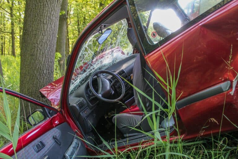
Drivers who misjudge these distances or who begin passing maneuvers in marginal situations cause the head-on collisions that make Highway 93 one of the deadliest roads in the state. These are not fender benders. They are high-speed front-impact collisions between vehicles with a combined closing speed that exceeds anything the human body was designed to survive.
Motorcycle and Bicycle Vulnerability
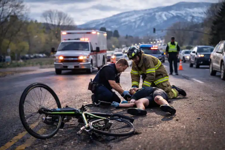
Highway 93 is popular with motorcyclists and cyclists attracted by the scenery and the challenging terrain. Both groups face elevated risks on this corridor.
Motorcyclists on Highway 93 are vulnerable to drivers who fail to see them during passing maneuvers, at intersections, and during lane changes. The visual complexity of the foothills backdrop can make a motorcycle less conspicuous against the landscape. A driver scanning for oncoming traffic before initiating a pass may not register a motorcycle approaching at highway speed until it is too late.
Cyclists on Highway 93 face a narrower version of the same problem. The road shoulder varies from adequate to nearly nonexistent depending on the segment. Cyclists riding on a narrow shoulder are separated from vehicles traveling at 55 miles per hour by inches. A driver drifting toward the shoulder while distracted, adjusting a GPS, or reaching for a coffee creates a collision that is almost certainly fatal for the cyclist.
Both motorcyclists and cyclists are disproportionately represented in Highway 93 fatality statistics relative to their share of total traffic volume. The lack of physical separation between these vulnerable road users and high-speed motor vehicle traffic is a design limitation that the current road configuration does not adequately address.
The Rocky Flats Connection
The northern section of Highway 93 passes adjacent to the Rocky Flats National Wildlife Refuge, the former site of the Rocky Flats nuclear weapons production facility. While the environmental history of the site does not directly affect accident liability, it does affect the corridor in practical ways.
Development restrictions around the former Rocky Flats site have limited the options for widening or realigning Highway 93 in its northern segments. Land that might otherwise have been acquired for highway expansion carries environmental constraints that complicate infrastructure planning. This means the two-lane configuration that makes the corridor dangerous is likely to persist longer in the northern segments than it might otherwise.
The Rocky Flats area also generates recreational traffic. The wildlife refuge attracts hikers, cyclists, and visitors who access trailheads along or near Highway 93. This adds turning traffic, parked vehicles near the roadway, and pedestrians near a high-speed corridor, each of which introduces additional conflict points.
Improvement Projects and Their Limits
CDOT and Jefferson County have invested in safety improvements along Highway 93 over the years. A median cable barrier was installed on portions of the corridor to reduce head-on collisions. Intersection improvements at major cross streets have been completed. Speed limit adjustments and enhanced signage have been implemented in high-accident areas.
These improvements have saved lives. The cable barrier in particular has prevented crossover accidents that would otherwise have been fatal. But the improvements are not uniform along the entire corridor. Gaps in the cable barrier, segments without adequate shoulders, and intersections that have not yet been upgraded continue to produce accidents.
The long-term solution that many transportation planners have discussed, widening Highway 93 to a four-lane divided highway for its entire length, faces funding constraints, environmental review requirements, and land acquisition challenges that push full implementation years or decades into the future. In the meantime, the corridor continues to carry two-lane traffic volumes that belong on a four-lane road.
Legal Complexity After a Highway 93 Crash
Accidents on Highway 93 frequently involve legal issues that go beyond a simple two-vehicle negligence claim.
Head-on collisions from failed passing attempts present the clearest liability scenario. The driver who crossed the center line bears primary responsibility. But even in these cases, questions arise about whether the passing zone markings were adequate, whether sight distances met engineering standards, and whether road conditions such as worn pavement markings or obscured signage contributed to the driver’s decision to pass.
Accidents involving road design deficiencies may implicate CDOT and Jefferson County. If the absence of a cable barrier in a particular segment, inadequate shoulder width, deficient sight distance at a crest, or substandard intersection design contributed to the crash, government entities may share liability. The 182-day notice requirement under the Colorado Governmental Immunity Act applies to all such claims.
Wind-related accidents raise questions about whether commercial vehicle operators exercised appropriate caution for known conditions. The Highway 93 corridor is subject to high wind advisories with significant frequency. A commercial driver who operates a high-profile vehicle through this corridor during a wind advisory without reducing speed or pulling over may be liable for wind-related loss of control.
Wildlife collisions occur along the corridor, particularly in areas adjacent to open space and the Rocky Flats refuge. While wildlife strikes themselves may not involve another liable party, a driver who swerves to avoid an animal and crosses into oncoming traffic creates a liability scenario, as does a driver whose excessive speed prevented them from stopping safely when an animal entered the roadway.
If you have been injured in an accident on Highway 93 between Golden and Boulder, the beauty of the drive does not reduce the severity of your injuries or the complexity of your claim. Call Flanagan Law at 720-928-9178 for a free consultation. We will investigate the road conditions, the driver conduct, and every contributing factor to build the strongest possible case for your recovery.
Frequently Asked Questions
Has the cable barrier on Highway 93 reduced fatalities?
Yes. Sections of Highway 93 where median cable barriers have been installed have seen significant reductions in crossover and head-on collisions. However, the barrier does not cover the entire corridor, and segments without the barrier continue to experience the head-on collision pattern that the barrier was designed to prevent. If you were injured in a section without a barrier, the question of whether one should have been installed may be relevant to your claim.
Can I sue if a passing driver caused a head-on collision that injured me?
Absolutely. A driver who crosses the center line to pass and causes a head-on collision has violated Colorado traffic law and is liable for resulting injuries. These cases typically involve severe injuries and significant damages. If the passing driver was killed in the collision, you can pursue a claim against their estate and their insurance policy.
What if wind caused the accident on Highway 93?
Wind alone does not eliminate liability. Drivers have a duty to adjust their driving for known conditions. The Highway 93 corridor is a well-known wind hazard, and drivers, particularly commercial operators with high-profile vehicles, are expected to exercise appropriate caution. If a driver failed to reduce speed, failed to pull over during dangerous wind conditions, or operated a vehicle that was particularly susceptible to wind without taking precautions, they may be liable for a wind-related accident.
Are there plans to widen Highway 93 to four lanes?
Various proposals for widening Highway 93 have been discussed for years. Portions of the corridor near the southern end approaching Golden have been widened, but the full corridor conversion to a four-lane divided highway faces significant hurdles including cost, environmental review, and land acquisition. No firm timeline for complete widening has been established. Until then, the two-lane configuration and its associated risks will persist.